Google maps bias

Gmaps Eco route

I really like Google maps and used it since 2005. I means whats not to like from offline support to step by step directions.

However… driving directions which most people use a lot has bias.

I drive around on a maxi-scooter (600cc Silverwing) with a headset in my helmet. I can not see my phone while driving around and rely on google maps to tell me where to go (only if I don’t know where I am going).

There are some annoyances which I have mentioned elsewhere, but yesterday while trying to drive to a friends house via the Pennines it became super clear some of the bias of google maps. Bias towards car drivers who care about fuel and not the wellbeing of the driver.

  • Google maps really needs the option to drive via A roads and B roads (only if essential). The fastest route always takes you technically faster route, down country lanes. The route gmaps took me on yesterday, was full of country lanes and one of them was water logged. Fine for a SUV or big car but not for a 2 wheel scooter.
  • The above might seem quite scooter focused but as my partner pointed out on a journey to Bournemouth this year. She would rather had taken a A road most of the way instead of the headache of navigating country roads for over an hour. I had hoped eco drive would solve this but nope.
  • Another one from my partner but makes sense for motorbikes too. When Gmaps finds a quicker route, there should be an option to set the default to the original route unless you press the screen. Its really frustrating to have it change the route without being able to see what’s changed.
  • Likewise this is useful for car drivers who don’t want to press the screen in the middle of driving.
  • The stops option is useful for the route but when you reach the stop, it doesn’t continue on to the next stop automatically unless you press the screen. This means you can plot the perfect route but then need to press the screen each time. This should be a preference option again.
  • I once drove down to Bristol and Gmaps just stopped talking to me. Usually if this happens, it means keep going. However when it goes quiet due to a bug/error theres no way to know, especially on a motorway. Maybe a small beep every set minutes would be most useful.
  • It would be great if Gmaps on mobile used some of the contextual data. For example Gmaps could understand if I’m on a motorbike oppose to a car. The time of day to pick routes with street lights. Weather conditions could be useful to avoid flood risk roads. Of course these can adjusted in the preferences, otherwise they could be annoying for some drivers.

I’m sure there are many more but this are ones which come to mind since yesterday. Its clear google maps isn’t ideal for non screen viewing.

My motorcycle holiday, circling the Isle of man

My journey map

I am back from the holiday circling the Isle of Man. It was a scary at first but a incredible journey. Its these type of things which really challenge you and makes you realize you can do so much more.

There is a lot to this journey which I’ll add more to once I sort out pictures, videos, etc. But generally I wanted to start the blog and see what I can add later (any suggestions are welcomed)

To answer my own points…

  • Its right at that place where I’m slightly scared and excited at the same time. Its been a while

the causeway coastal route

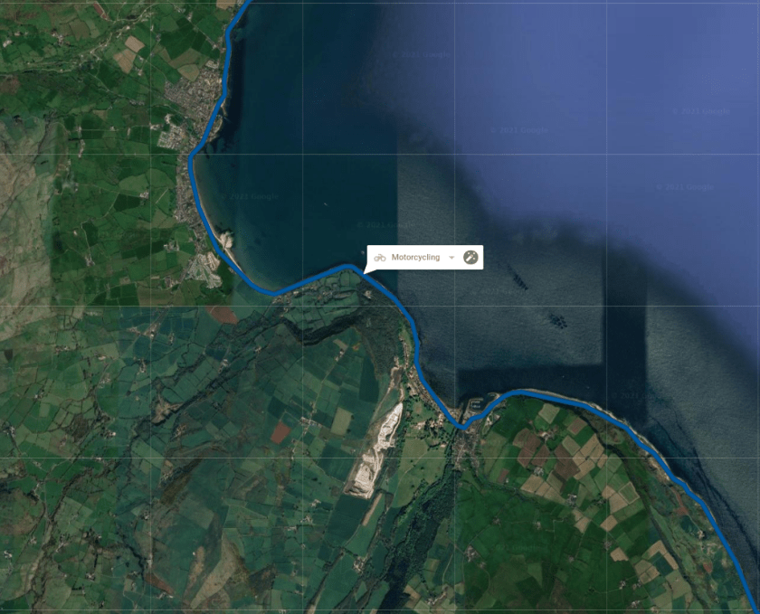
it was amazing and although quite scary at points, its made me want to do more traveling by scooter. There were moments when you remember the corners have no barrier especially on the causeway coastal route down from the Causeway to Belfast. Amazing path but also needs to be treated with caution.
Coastal road

In the end I got off the causeway coastal route at Larne only because it was getting dark and actually cold. The path is amazing full of spots to stop and even sit on the beach. With more time I would likely have stopped but the time was moving towards darkness and I certainly didn’t fancy the causeway coastal route in the darkness.

Mourne Mountains path

Going back on myself at Newcastle to ride through the Mourne Mountains was incredible, so quiet and I did consider doing the whole loop around.

Mountain ride

I did go to the giant causeway but it was fully booked, I really should have booked it soon as I knew but I’ll be back

  • I get to visit a new country

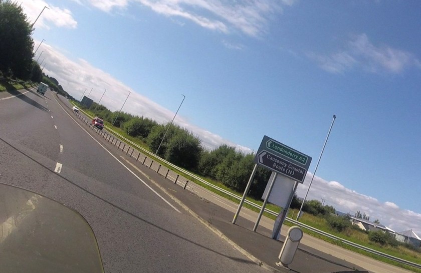
Sign for Derry

I have never been to Northern Ireland and always wanted to check it out. Although its part of the UK, its quite different and I found Belfast very different from other cities in the UK. Those motorways felt like something out of Ridge Racer. I will have to go back without the scooter to check out the scene within the city including the many museums.

I did get to Derry and saw some of the incredible wall art but didn’t get a chance to snap any while riding, I generally turn my GoPro off while in most built up areas. I certainly like to do a tour of the wall art next time.

  • I get to drive in Europe at long last

Ok yes Ireland is left hand drive, but technically I did drive in Europe and kind of forgot to take a picture of the border between Ireland and Northern Ireland (which if you have been paying attention doesn’t exist for good reason) but I was expecting something saying you have crossed over. On this note I did take my passport and driving license but never once showed it or was asked for it.

  • I do it all without flying, although I do wonder if the scooter’s overall carbon footprint is so great or not

I could work it all out but haven’t tried yet. In total I did 826.4 miles from home to home over 5 days, stopped for fuel 9 times but sometimes to just to top up the tank just in-case. In total I spent about 60 pounds on fuel but the price varied a lot between countries and where I was (motorway vs city)

Here is the full details, after the fold…

Continue readingMy motorcycle holiday, circling the Isle of man

5 years imprisonment for damage including to my scooter

Silverwing Scooter

The Criminal justice system have kept me informed about the case involving my scooter break in.

Scooter break in again…

One of the people received 5 years imprisonment, 7 years of driving disqualification and a criminal behaviour order for 10 years.  So it was worth the effort I put into chasing the police and doing a part of their work for them.

Obviously I now have 4 different and separate locks including chains of different thickness. Because I have scooter wheels I purchased the most thick chain and lock which goes through my wheels (not quite 20mm thick but close). On top of this, I use my alarm everyday and still have that gps tracker.

It might be a lot for a second hand Honda Silverwing but its mine and I’m not letting some idiots break my scooter for the 3rd time. I was happy to stand up in court and say what I saw. Ok I didn’t get any pay out for it, I didn’t claim on the insurance but I’m glad some justice was served.

Where are all the Electric Maxi-scooters?

What is a maxi-scooter

I do enjoy my Honda Silverwing scooter but I keep thinking its time for a Electric vehicle. Especially seeing how it currently wouldn’t pass the new London ultra low emission zone and frankly its time for more environmental focus.

The problem I see is there are two extremes when it comes to electric motorcycles/scooters.

At one end you have your electric scooters (don’t look up electric scooters, as you get something very different and questions of where to ride them). I remember looking at scooters to hire in Berlin, thinking where the disc breaks and will car drivers actually see you on such a small thing? But at the other end there are electric motorcycles like the new Harley Davison livewire. But theres little in between.

What is needed is maxi-scooters which are electric powered surely? However I have had such a hard time finding them.

The closest I can find is the BMW Cevolution


Whats my options for a new scooter?

my silverwing

I love my Honda Silverwing, its one heck of a scooter at 600cc. But the time has come to think about replacing it with something else. So I thought I’d just see what people recommend. I do want…

  • A scooter, not a motorbike… Yes I know but it suits me better
  • A CC of about 600 or more, I can’t really imagine dropping down now.
  • Lots of storage space and ability to put my Givi box on the back
  • Automantic transmission (although all scooters this size have that)
  • I’d love to have a electric or hybrid scooter of a good road size but there seems to be so little of them.

I guess everytime I go somewhere, I’m on the look for what kind of scooters they have.

Thoughts are welcomed, but don’t just say get a motorbike…

Ride out with the Autographer camera


View Larger Map

A while ago I went for a ride out across to Sheffield with the Autographer camera. I went over the Woodhead pass and back via Snakes pass. Some of the images are wonderful and it would be great to share them on a map using something like Flickr, Strava or elsewhere?

Photoblogging with the Autographer

However I found out that the autographer doesn’t actually add the geotags to the photos directly. Instead it creates a file which a desktop application reads and adds to the photos directly afterwards. Its a bit weird because almost all camera phones support geotagging directly so you would have thought the autographer would also do the same?

Photoblogging with the Autographer

I like the Autographer because it writes most things to the storage like you would expect a camera to do. Making it highly usable on Linux. However the lack of geotagging without the application is painful and seems a oversight. I can’t understand what they were thinking… Yes additional data might not work in the EXIF data stream but geotags are very common now.

If I was to do it again, I would do it with a GoPro and mount it somewhere better than around my neck. Seen quite a few riders with them strapped to the helmet, which makes the most sense.

Riding down the Hope Valley


View Larger Map

On Sunday afternoon, it was nice and warm and after 4 hours of Volleyball training, I decided to give Tim’s advice of doing the Hope Valley road a try.

I have to say I need to find a way to attach my Xacti Camera (thinking this could be the hardware project I’ve been meaning to do with FabLab all this time) to the Silverwing or maybe get a Go Pro. There were some stunning views which I wanted to stop and capture but while driving the dangerous path of Snakes pass from the Glossip end, its not advisable to stop a lot. Got to say the trip from Hope Valley into Lancaster was very hilly and amazing to drive, just a shame I was looking directly into the Sunset…

Anyway you can see the path I took which is a lot cleaner than my last one.

A long ride out to sheffield and back

Ride across the Peaks

So this time I went through the mountains of the pennines along the woodhead crossing, stopped in Sheffield and then back through along the forever talked about Snakes pass.

To be honest Snakes pass, wasn’t as scary as I imagined. But there certainly were some corners which I can totally see someone less aware getting caught on. I think I prefer the woodhead crossing for its pure speed and pleasure of driving on top of the mountains but I can see why Snakes pass is a heck lot quicker.

I was amazed at the lake in the middle of the pennines, from my brief look, it seems like there is a pebble/rocky beach too. I might be wrong, I imagine its maybe all just sinking mud and thats certainly not the place to get caught out.

Hope valley is next on my list, but if the weather gets any worst I certainly won’t be driving around the pennines. It was pretty treating when I went out on Saturday, cant even imagine what its like in rain and in the dark!


View Larger Map

For some reason, my phone went a little nutty in the middle, so I ended up with 2 KML files, using Oxygen XML I was able to put the data together. You can’t beat side by side view…

Documenting a ride

HONDA SILVERWING

I now have my scooter (Honda Silverwing) back on the road, thanks to Matt.

I have been on a few longish journeys around but not anything major. So today I went for a long ride in the mountains (well there officially the peaks  but…). I keep meaning to go down the famous Snakes Pass. But there seems to be a number of different routes which are interested rides through the peak district.

Using my tracks on my phone I was able to create a map of where I had gone complete with all the riding info. I was surprised to find you could easily export it to Google Drive and therefore easily something/somewhere else.


View Larger Map